Projects
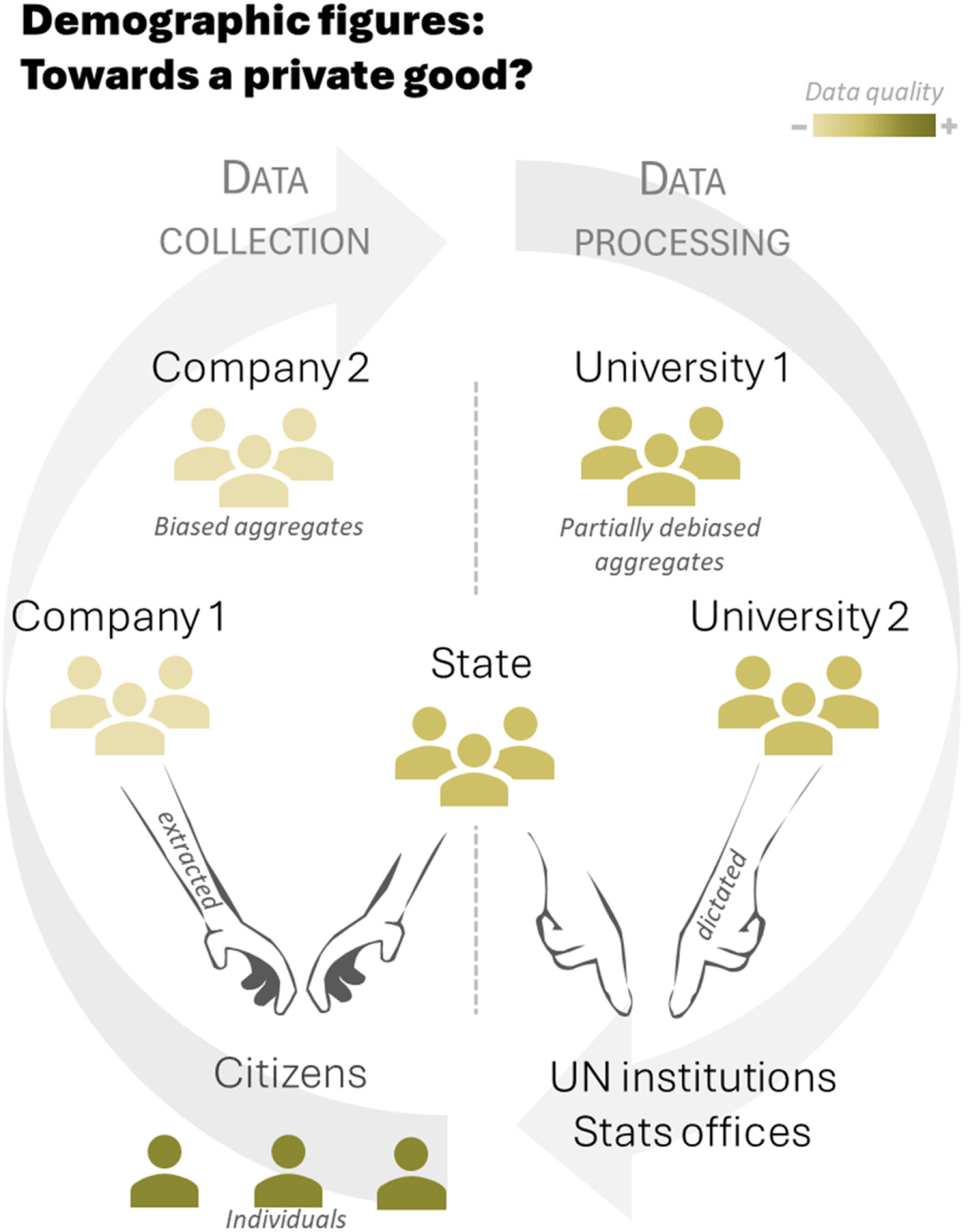
Demographic figures at risk in the digital era: Resisting commodification, reclaiming the common good
After eigh years working as a population researcher leveraging digital data for quantifiying population, I have set aside some time to think about the ethical and political consequence of the commodification of demographic data.
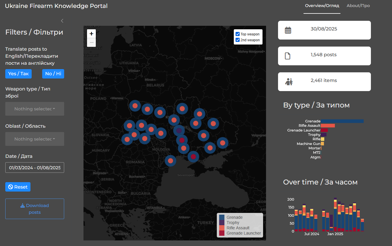
Ukraine firearm knowledge portal
I developed for the Small arms survey project a dashboard visualising data on arms seizure in Ukraine. It gives a fast, interactive view of how firearms are discussed on Ukrainian social media, with a map, charts, and a searchable table. It’s built to be maintainable: data processing happens inside DuckDB, the UI updates reactively, and administrators can refresh the whole dataset with a single button that launches pre‑configured GitHub workflows.
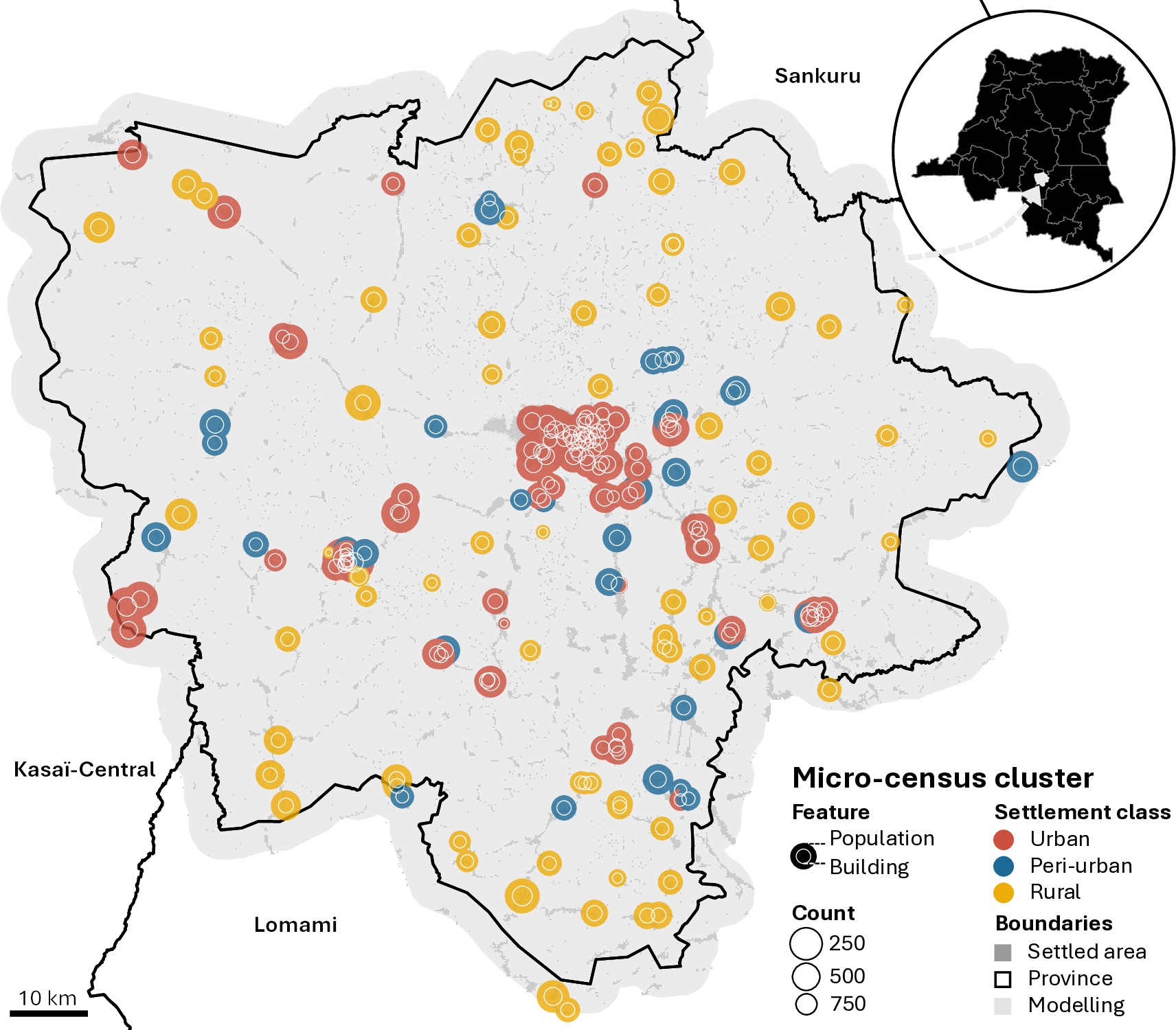
Modelling population in Kasaï-Oriental, DRC
We published a new study uses satellite data and Bayesian modeling and a novel building model component to estimate population in Kasaï‑Oriental, DRC, supporting better local health planning.
Can Satellites Replace Censuses? What We Learned from Colombia
How accurate is satellite data for estimating population where censuses can't reach? We benchmark satellite-derived models in Colombia—and reveals when machine learning falls short and why Bayesian models matter.
Population nowcasting network
We are building a collaboration between universities for advancing knowledge of nowcasting populations, mobility, and migration by combining Bayesian and other methodologies with digital trace and traditional data sources
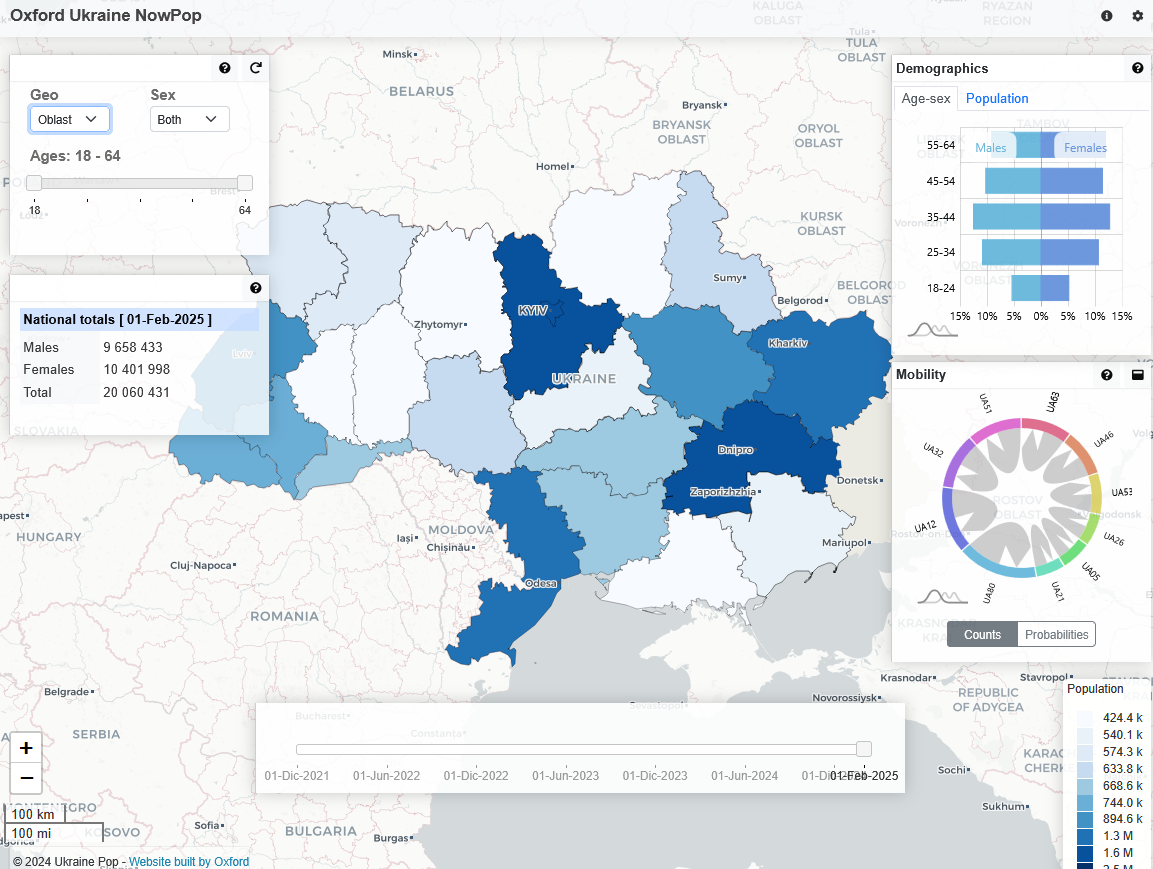
Ukraine NowPop: internal displacement in Ukraine
I am currently working as a population data scientist on the NowPop project, a large-scale population model for Ukraine, using social media and mobile phone data to nowcast population displacement since the full-scale invasion in February 2022.
Collaboration with the Colombia Statistics Office
The Leverhulme Centre for Demographic Science is partnering with Colombia’s Stats Office to rethink how population counts are produced between censuses. By combining Bayesian modelling, administrative records, and satellite data, the project is pioneering new methods to generate accurate annual population estimates.
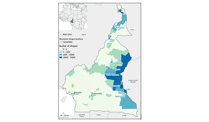
Mapping refugees in Cameroon with high-resolution
In collaboration with UN High Commissioner for refugees, we innovated the mapping of displaced populaions by unlocking the power of registration data using satellite imagery and advanced spatial modelling
Radical Routes
I am supporting the UK network of mutually-owned housing cooperatives called Radical Routes and more speficially the Finance Working Group.
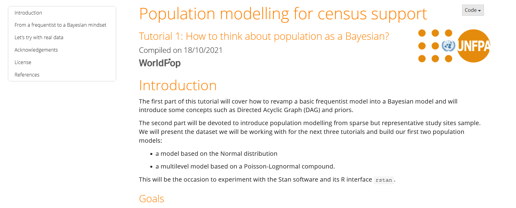
Statistical population modelling for census support
I led a one-week workshop based on a series of hands-on tutorial to grasp the bases of the Bayesian approach for population models. All the materials, including Stan code, written tutos and presentation are available online on a dedicated website. It was first delivered to the Brazilian Stats Office (IBGE).
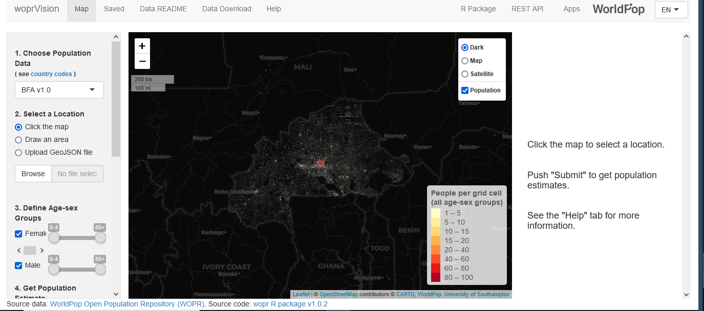
woprVision: a shiny app to visualise Bayesian predictions
I helped develop woprVision, a multilingual interacive application to visualise and retrieve Bayesian population estimates. We use woprVision at WorldPop as part of our data release process to support (1) mean estimates spatial aggregation for people with limited GIS-skills (2) full distribution aggregation for coomputing correct credible intervals.
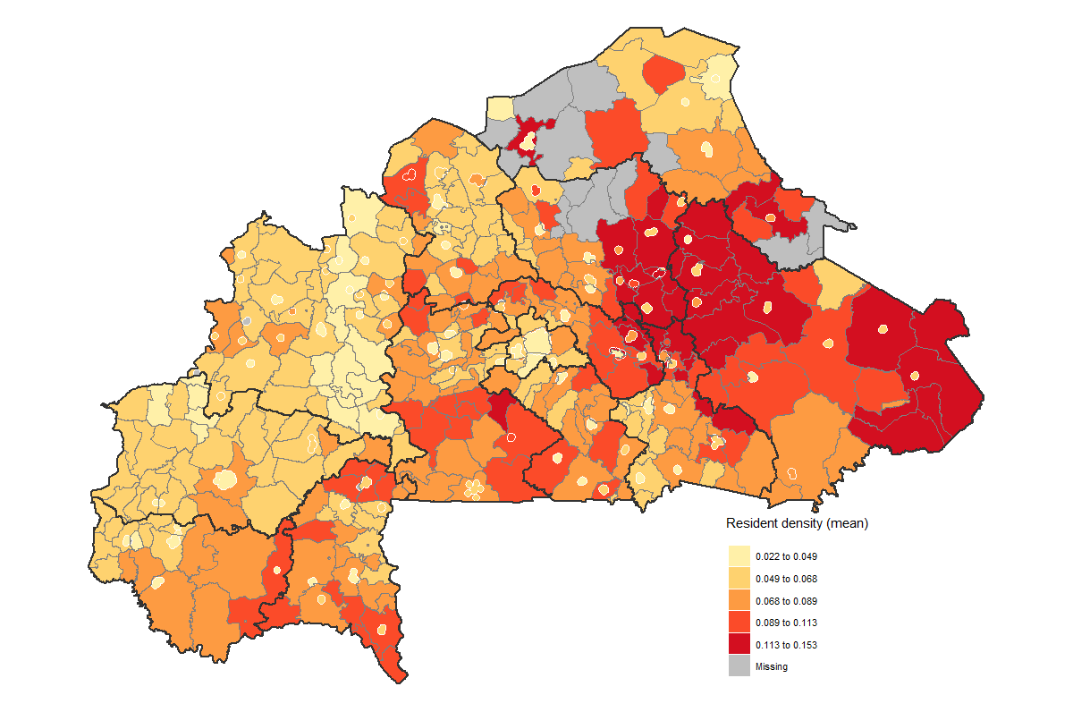
Hybrid census in Burkina Faso: Bottom-up population modelling
I developped a Bayesian bottom-up population modelling to adress the challenge of the incomplete 2020 census in Burkina Faso. The model was combining GPS household location with remote sensing product in a Bayesian hierarchcical framework. The output is a hybrid gridded population that was endorsed by Burkina Faso Statistics Office.
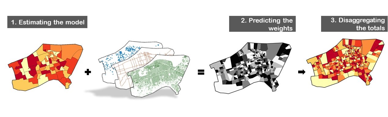
Small area population estimates using random forest top-down disaggregation: An R tutorial
I have co-authored an R tutorial on how to develop top-down population models, which consists in disaggregating administrative estimates to a finer spatial resolution. We first shared this tutorial with the Brazilian Stats Office (IGBE).
CoopCycle: we socialize platform
Since 2017 I am a vice-president of the CoopCycle association that fights for fair working rights in the bike delivery sector.